CAPITOL REEF NATIONAL PARK in south-central Utah is probably the southwest's least-known
national park. The scenery here is not as immediately dramatic as in, say, Zion, but the flip side is
that Capitol Reef's trails are much less crowded. I've visited Capitol Reef
on many occasions, and there are at least a week's worth of good day hikes.
The park also has some technical canyons (though the best-known slot canyons lie
to the south-west in the Escalante) and longer routes best tackled as backpacks. This page
summarizes my recommendations for Capitol Reef day hikes.
(1) Upper Muley Twist canyon
Trailhead: Upper Muley Twist trailhead, just off the Burr trail road along the unpaved
(and rough) Strike Valley Overlook Road. The turn-off is about a mile west of the prominent
Burr trail switchbacks. Coming from Boulder, Utah, it's a few miles past the end of the pavement
to reach the well-signed turn-off. With a 2WD you'll probably want to stop at the parking area shortly
after the turn-off and walk the rest of the way (about three miles) to the formal start of the
hike.
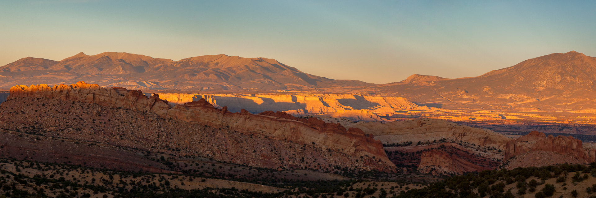
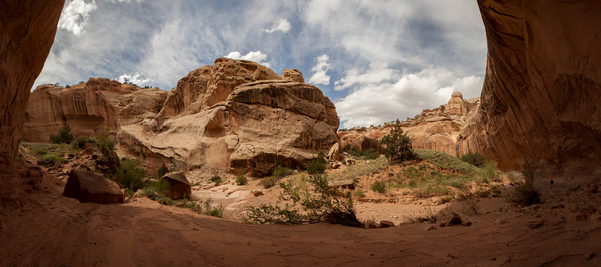
 Panorama from the rim of Upper Muley Twist
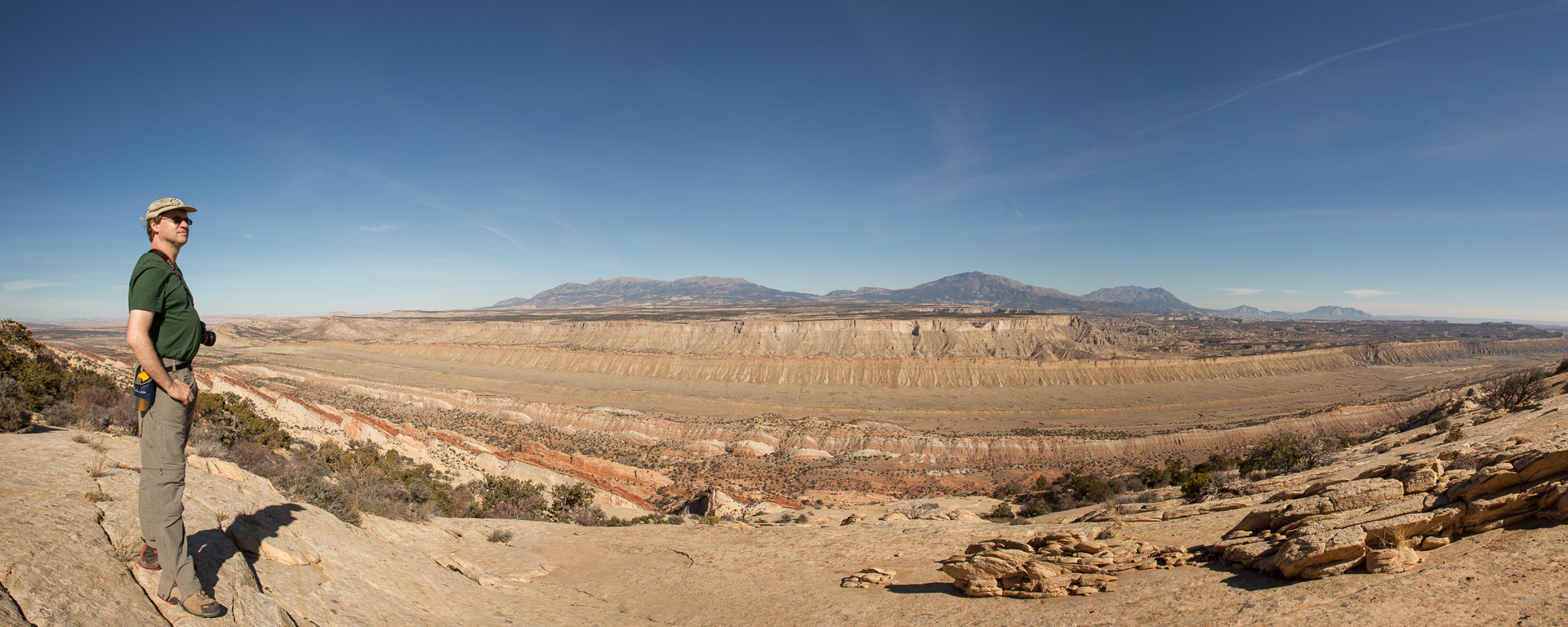
The trail - or route, since it's mostly trail-less - through Upper Muley Twist Canyon is my
pick for the best hike in Capitol Reef National Park. It's a moderately difficult
full-day hike that has a little bit of everything - an interesting canyon, natural arches,
and a ridge-top walk with a spectacular panoramic view. The hike is probably best done in Fall,
when there can be strikingly colors in the canyon, but it's recommended at any time of the year
apart from summer, when it would be extremely hot. The video below shows a trip in mid-June.
Once you've walked (or with a good 4WD driven) to the start of the
hike proper at the Strike Valley Overlook parking lot the first four miles follows the
bottom of Upper Muley Twist as it meanders northward. Saddle Arch is passed at about the
two mile mark. At the four mile mark a short section of narrows is bypassed via a cairned
route on the right-hand-side, and shortly after that further cairns mark the start of a
steep climb up the rim of the canyon to the east. Reaching the rim is the highlight of
the hike, as a magnificent panorama of the Waterpocket Fold running north to south is
suddenly revealed. This is a good spot for lunch, before heading south along the rim
for a couple of miles (some care is needed here to stay on route) and dropping back
into the canyon to rejoin the trail back at Saddle Arch.
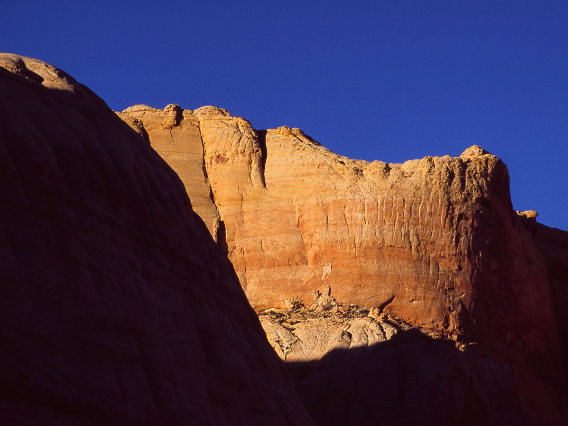
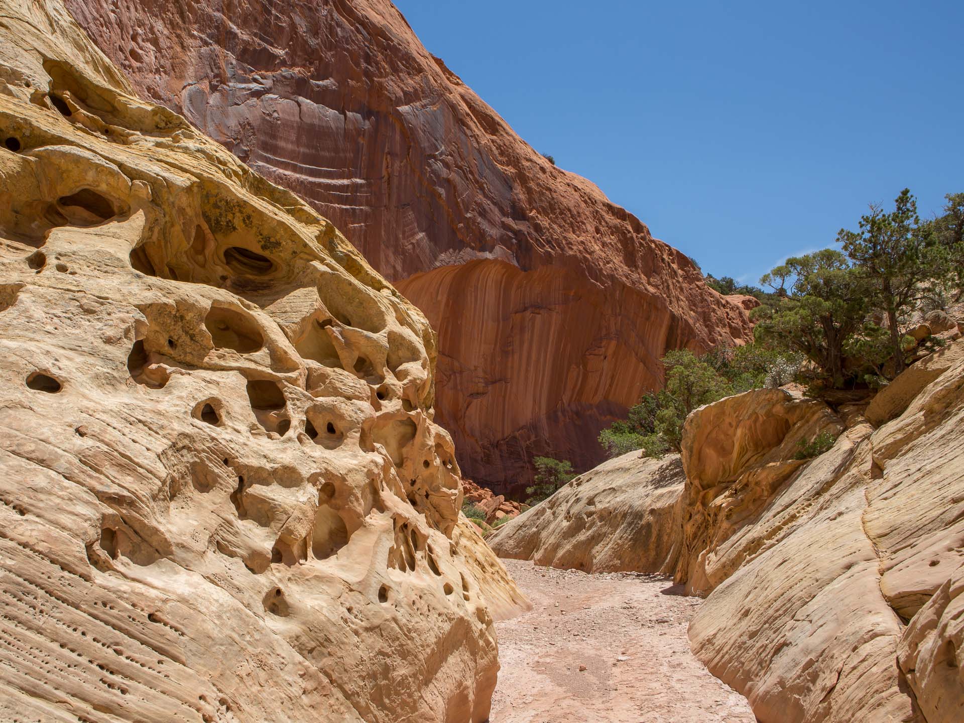 Lower reaches of the canyon
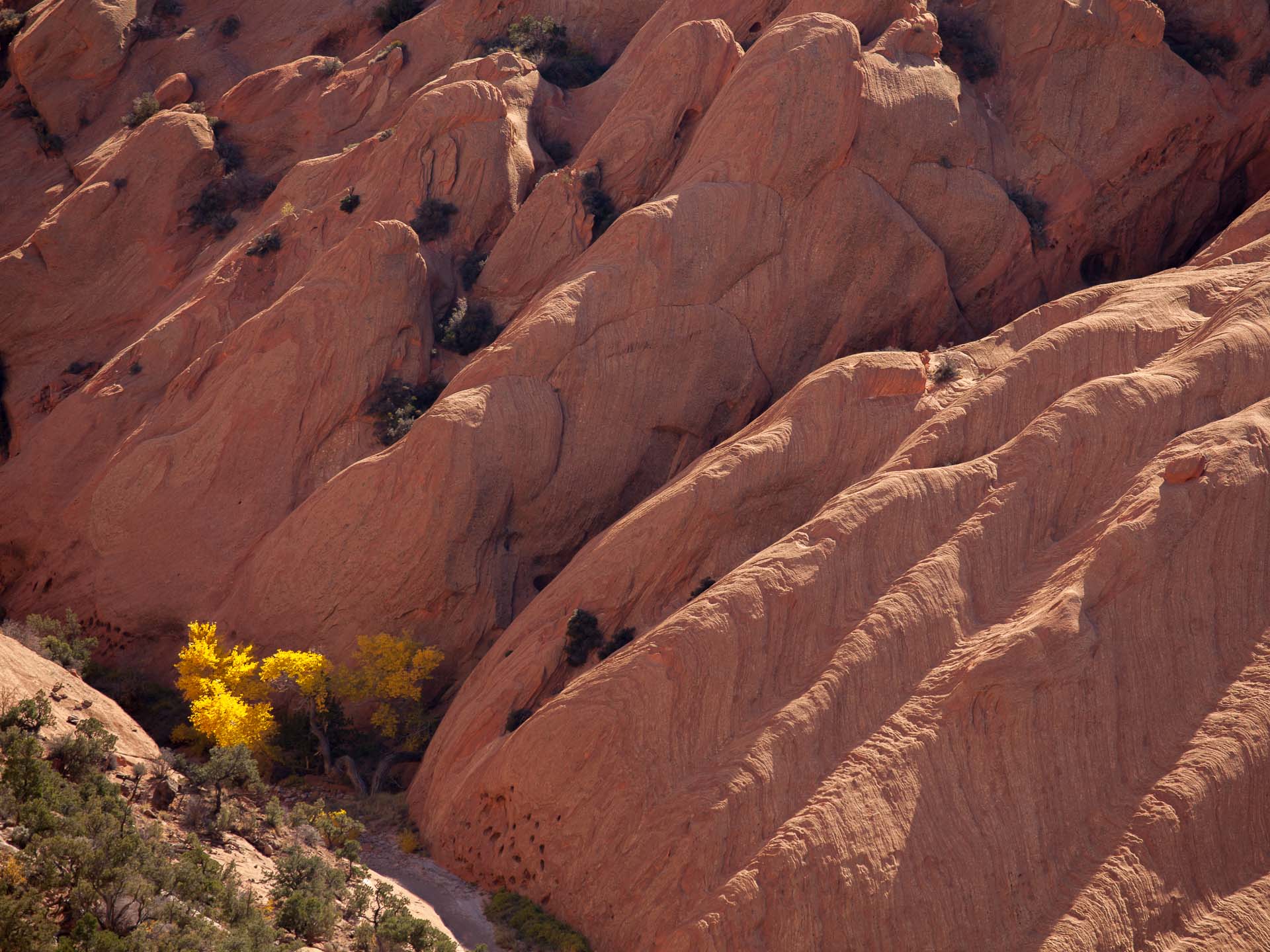 Upper Muley Twist in Fall
Total distance for the (partial) loop is about 9 miles if you start at the Strike Valley Overlook
parking area, or about 15 miles if you start at the 2WD parking area further
down the road.
Trailhead: Chimney Rock trailhead. Cross the road and hike down the obvious
(and signposted) wash toward Sulphur Creek. If you descend the whole canyon you'll
emerge next to the Visitors' Center. A shuttle would be worthwhile, as it's several
miles uphill along the road back to Chimney Rock. It's possible to walk along the road,
but it's not very pleasant.
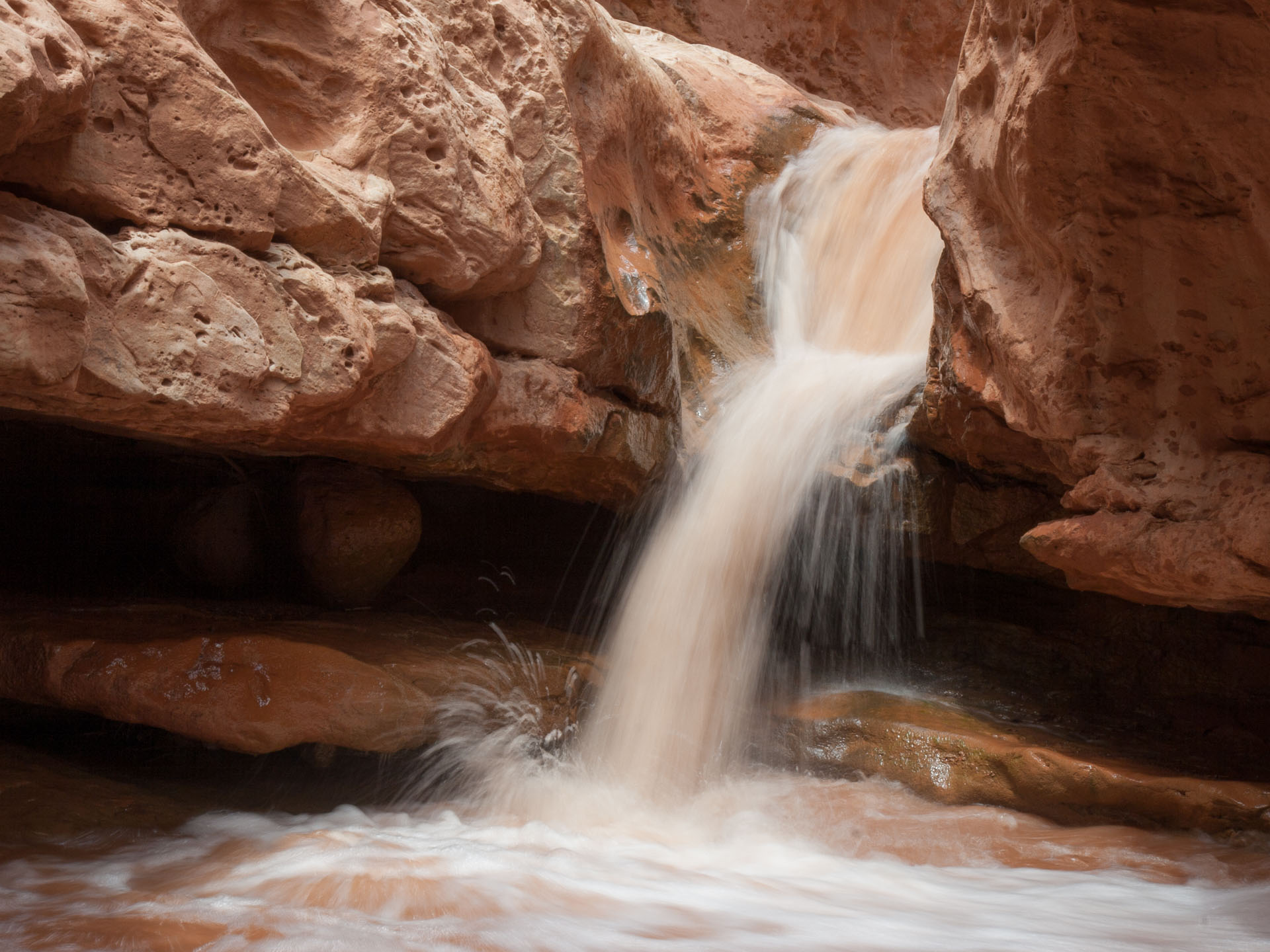 Upper waterfall in Sulphur Creek
 Sulphur Creek narrows
 Waterfall near the Visitors' Center
Sulphur Creek is a small permanent stream that flows through a short section of
deeply incised meanders (the "Goosenecks", which can be viewed from above at the
Goosenecks Overlook) before entering a section of moderate narrows that leads
eventually to an exit near the park's Visitors' Center. The canyon can be
explored starting either from the bottom (at the Visitors' Center), or by
entering the canyon from the top by following the obvious dry wash on the
south side of the road opposite the Chimney Rock parking area. Starting from the
Chimney Rock end it's about 2 miles to reach Sulphur Creek, after which the
rest of the hike (about 4 more miles) involves frequent wading and fording
of the creek. The canyon is quite attractive, and although the setting
does not compare with the very best narrow canyons in the Southwest
(the
Zion Narrows and
Paria
Canyon / Buckskin Gulch) it makes for a pleasant hike that's a bit more
adventurous than your typical maintained trail.
There are two things to be aware of before tackling this hike. First, the
canyon is quite narrow, and hence best avoided if the water level is high
(after recent rain) or, especially, if storms and flash floods threaten.
Second, the obstacles along the route - three 6-8 foot-high waterfalls that
need to be bypassed - are not quite as trivial as some descriptions
I've seen suggest. The final waterfall near the Visitors' Center, in
particular, looks taller than it is from above and can be a bit intimidating
if the creek is running at a good volume. If simple climbing isn't
your thing you might want to try a different hike (or just go out-and-back
from the top to the first waterfall, which makes for a nice half day in its
own right).
Trailhead: The trailhead for this hike is the same as for Hickman Bridge, on Highway 24
not that far from Fruita and the Visitors' Center. There's parking along the road in the (quite
likely) event that the parking lot is full.
The Navajo Knobs is one of the maintained trails in Capitol Reef, and it's a bit different from
most in that it climbs above rather than through a canyon. Starting from the trailhead next to the
Fremont River, it's a steady climb that follows benches along the canyon rim to reach the "Knobs" -
small rocky outcrops that give a 360 degree panorama of the park. You're never far
from Highway 24, but the trail is high enough up that it doesn't feel like you're close
to the road.
Total distance for this hike is about 9.5 miles, with 2350 feet of elevation gain to the Knobs.
There aren't too many hikers and I found it to be an enjoyable, not too difficult, day out with
excellent views.
Trailhead: The trailhead and parking area are on the Notom-Bullfrog road
about 12 miles south of the junction with Highway 24. The road is now paved going
south as least as far as the trailhead for this hike.
Sheets Gulch is one of three narrow canyons that can be explored on the eastern side of
Capitol Reef (the others are Burro Wash and Cottonwood Wash). There's no maintained trail
through the canyon, but the route is quite straightforward and once you get into the Gulch
proper (the first couple of miles are a broad sandy wash) navigation is simple. Most of
Sheets Gulch is just a fairly narrow, deep, canyon, but there are moderately long
slot sections that include some obstacles. On a nice day at the end of April there was
no water at all in the canyon and I found the obstacles easy to surmount, but
of course conditions change and your opinion might be different! The slot sections are
extensive enough that this is definitely a canyon to avoid if there's any flash flood
danger.
We went as far as an impassable pour-off that's about 5 or 6 miles in from the trailhead.
It's actually possible to bypass the pour-off and continue further, but it makes a
good turnaround point for a moderate day hike. Sheets Gulch is not the most incredible
destination in the area, but it's an attractive canyon and made for a varied quiet
hike with a little bit of scrambling thrown in.
(5) Grand Gulch / Frying Pan trail loop
 Grand Gulch
Trailhead: The hike is a near-loop starting at the Grand Gulch trailhead on
Highway 24, east of the Visitors' Center, and ending on the south side of the road
opposite the Hickman Bridge trailhead (also on Highway 24). With two cars you might
as well leave one at each trailhead, but if not they're only separated by a couple of miles
and walking along the road is a reasonable alternative.
Combining the Grand Gulch, Cassidy Arch and Frying Pan trails makes for a near-loop that
hits many of the scenic highlights of the core region of Capitol Reef near Torrey. Starting at
the Grand Gulch trailhead on Highway 24 the route starts by following the dry wash of
Grand Gulch through a short but quite impressive section of narrows (one would want to
avoid this spot in bad weather, even if it's not as dangerous as a real slot canyon). Before
reaching the parking lot at the far end of the Gulch, locate the trail that leads off to
the right and climb steeply out of the canyon to reach Cassidy Arch about 2 miles after
leaving the floor of Grand Gulch. Cassidy Arch sits on the rim of a slickrock plateau
with sheer cliffs (and excellent views) on each side. It's surprisingly easy to walk over the arch
(in fact from on top you don't even realize it's an arch) but still it's a vertiginous
setting that will keep parents alert!
 Cassidy Arch
 Headed toward the Frying Pan trail
From the arch you need to backtrack a short distance before picking up the Frying Pan
trail and heading in a generally northward direction back toward Highway 24. The Frying
Pan trail dips into a small canyon midway but mostly stays high, affording very good
views out across the slickrock toward the monoliths that line the Fremont River Canyon.
It's easy pleasant hiking that eventually brings you back to the highway opposite the Hickman
Bridge trailhead, about two miles west of the starting point. Total distance for the
loop is about 11 miles.
(6) Chimney Rock Canyon to Spring Canyon
 Lower Spring Canyon
Trailhead: Chimney Rock trailhead on Highway 24 west of the Visitors' Center. There are
various option for hikes from this trailhead. The shortest is an excellent 3.5 loop that attains
a high point overlooking Chimney Rock and the main scenic drive through the park. Longer hikes
extend into Spring Canyon. I combined an out-and-back into lower Spring Canyon with the Chimney
Rock loop, but with a shuttle you can descend Spring Canyon all the way to the
Fremont River, ford it, and rejoin Highway 24 close to Grand Gulch.
The Chimney Rock trail is a short (3.5 miles) and popular loop hike that starts just north of
Highway 24 a few miles west of the Visitors' Center. The loop makes for a good short hike in
itself (from the high point there's an excellent panorama of Capitol Reef and
Boulder Mountain), which can be extended into a full day hike of 10-15 miles by following
the trail north into Chimney Rock Canyon. The trail departs from the loop about one mile
past the top of the switchbacks, and follows the dry canyon for 1.5 miles to its junction
with Spring Canyon. Once you leave the loop you may not see another person all day.
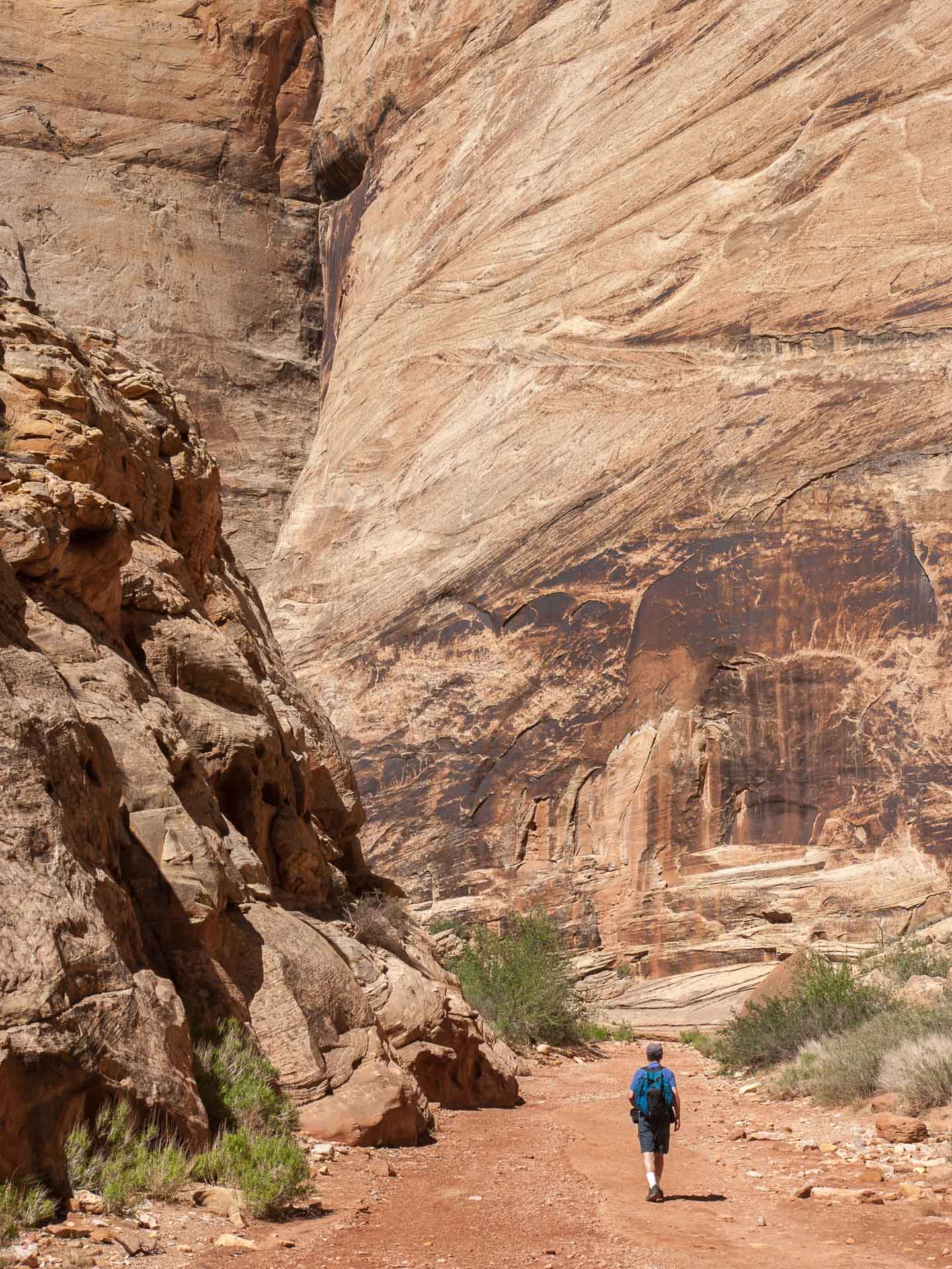
Don't rush this first section - Chimney Rock Canyon is extremely impressive and
for me walking quietly through the bottom of this canyon amid towering walls stained with desert
varnish was the highlight of the hike.
 Bypass trail above Spring Canyon narrows
 Along the Chimney Rock loop
From the junction of Chimney Rock Canyon and Spring Canyon it's possible to explore either
upstream or downstream (though there's no actual running water). Heading downstream there
are 6.5 miles of mostly straightforward hiking to reach the Fremont River, which can be
forded to rejoin Highway 24 for a one-way shuttle trip. The only obstacle is a section
of narrows containing falls that need to be bypassed on a narrow, slightly exposed trail.
The canyon downstream of the falls is narrower and more interesting than the part above,
so it's well worth continuing past the narrows. The canyon
upstream of the junction is
also worth exploring. About 1-1.5 miles upstream of the junction there's
a perennial spring, and the canyon here is green and very beautiful. You can hike beyond
the spring for several miles further without any problem - in fact there's a challenging
backpacking route that
enters the canyon at the top end (starting from Holt Draw)
and descends all the way to the Fremont River.
With a shuttle the best option would probably be a one way descent ending with a crossing
of the Fremont River, which would make for about a 10 mile hike. But one can also do a
number of 10-15 mile out and back hikes by combining the Chimney Rock loop with excursions
of various lengths either downstream or upstream in Spring Canyon.
Trailhead: There are two possible trailheads for hiking
Lower Muley Twist. I started from the trailhead along the Burr Trail road, just above the switchbacks that
lead down to the junction with the Notom / Bullfrog road. Coming from Boulder, the trailhead for Lower Muley
is a short distance further along the road past the start of the Upper Muley hike.
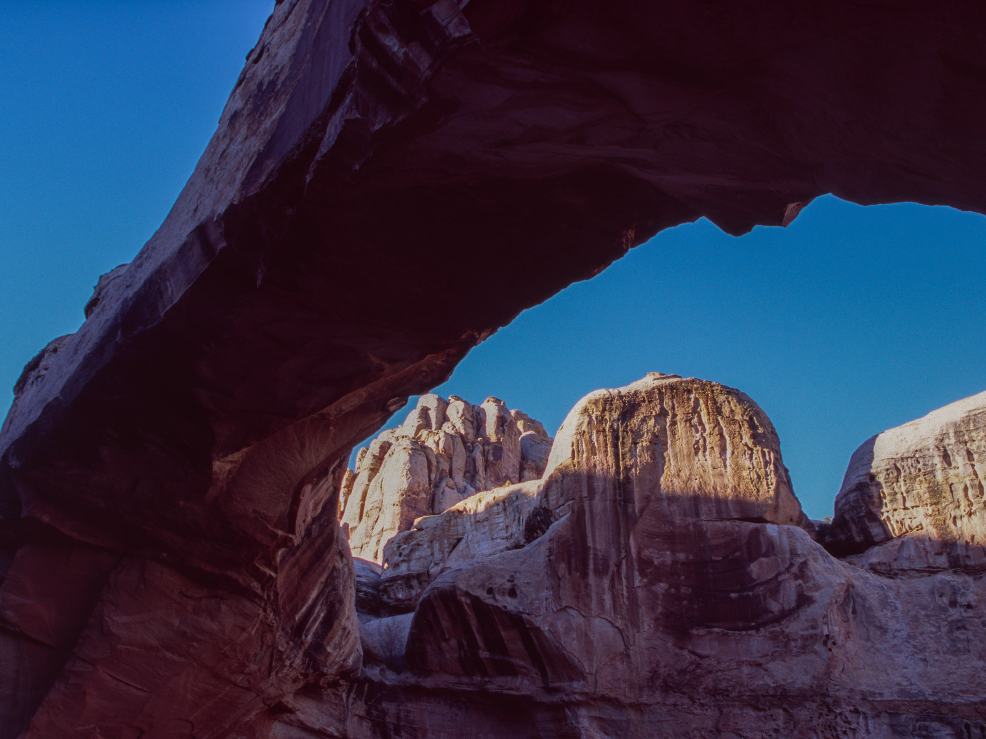
 Alcove in Lower Muley Twist, Capitol Reef National Park
Lower Muley is, self-evidently, the downstream continuation of Upper Muley Twist
canyon, which is divided by the Burr Trail road. The lower part of the canyon is deeper, with some short sections of
narrows (possibly requiring either a bypass or some wading if it's been raining recently), and moderately impressive
alcoves. The canyon has some historic interest - this was a route taken by Mormons in the late 19th century - and it
makes for a pleasant hike though not one to compare with Upper Muley. There's no particular destination, but starting from the Burr Trail
road an out-and-back of 10-12 miles makes for a satisfying day. You can also go further, and this would be a mellow
place to camp as the canyon sees very few visitors. Avoid in the summer though: this would be a baking hot furnace
and not a lot of fun.
Trailhead: Hickman Bridge trailhead, off Highway 24 near the Visitors' Center.
 Sunset light from the trail
 Hickman Bridge, Capitol Reed
The Hickman Bridge trail is a short one-mile leg-stretcher off Highway 24 that
leads to a good natural bridge. There are nice vistas of the main canyon
(somewhat marred, of course, by the presence of the highway), especially in the
late afternoon light. From the same trailhead it's possible to hike 9.5 miles
out and back along the Navajo Knobs trail, described above
Capitol Reef accommodation and dining
For the hikes in the northern part of Capitol Reef (everything on this page
except for Upper and Lower Muley Twist) the most convenient place to stay is
Torrey, Utah. Torrey is a very small town (120 people) with a fair number
of moderately priced lodging options and a
handful of restaurants. "Cheaper is better" pretty much sums up the Torrey
dining scene, and I'd recommend the Rim Rock Patio
which serves excellent draught beer and inexpensive, serviceable pizza.
Torrey is 213 miles from Salt Lake City, 350 miles from Las Vegas, and
220 miles from Grand Junction in Colorado. You might also consider staying
in Boulder, Utah at the junction of Highway 12 and the Burr trail road.
Boulder is about an hour south of Torrey, and so less convenient for the
hikes in the northern part of Capitol Reef, but closer to the many excellent
hikes in the
Escalante region.