The Coast Range stretches for the better part of a thousand miles, from the US
border all the way up to the Yukon, and although the southern portion near
Vancouver isn't all that well protected (there's a lot of logging) there is still
an abundance of wilderness hikes. In planning our trip I made use of Kathy and
Craig Copeland's guidebook
Don't Waste
your time in the BC Coast Mountains, which is recommended but currently out of
print. The hiking guide you'll find in local shops is
103 Hikes in
Southwestern British Columbia, which is dry but otherwise serviceable. Together, these
guides cover much of the area near Vancouver, which includes not just Garibaldi but also
Golden Ears, Stein Valley and Skagit Valley parks.
More alluring still are the peaks that lie further to the north of the Coast Range. These
include Mount Waddington, which
at 13,186 feet is actually higher than any of the peaks in the Canadian Rockies. You
can't drive (or hike, unless you're up for a month-long expedition) to anywhere that's
remotely close to the base of Waddington and the mighty glaciers that surround it, but there are
trails in the general vicinity that are most easily accessed out of the town of Bella Coola on
the Pacific Coast. Some trails lie within Tweedsmuir
Provincial Park, but there are many more sparsely documented but probably spectacular hikes
in the region. I'm hoping to make it up there to check them out myself sometime, but it hasn't
happened yet.
[As an aside, Mount Waddington is so remote that it's quite a challenge to find a hike that
affords even a distant view of the peak. Your best bet is probably to hike to the top of
Perkins Peak in the Pantheon Range,
from where there is said to be a clear view of Waddington. But I haven't
actually done this!]
Bears and bugs
If your wildlife worries in the Coast Mountains start and end with bears, you're making a mistake.
Although there are both grizzly and black bears in these mountains, and normal care is
certainly sensible, bugs will almost surely be your most pressing problem. In the peak
hiking season dense swarms of black flies, which will envelope you the moment you pause
to rest or eat lunch, are almost everywhere. Don't rely on insect repellant - take
long sleeved shirts and pants and a net for the head to be on the safe side for days
when they're particularly bad.
Accommodation
My brother and I stayed in Whistler while hiking
Garibaldi, and this is probably the most convenient base for the hikes described on this
page. Whistler is primarily a ski resort, but it's still a pleasantly lively town
during the summer with an excellent range of restaurants, bars and breakfast places. If you prefer a slightly less
"urban" base - then Squamish might be a better
place to stay. Book early though, as there are fewer rooms to be had in Squamish
as compared to Whistler.

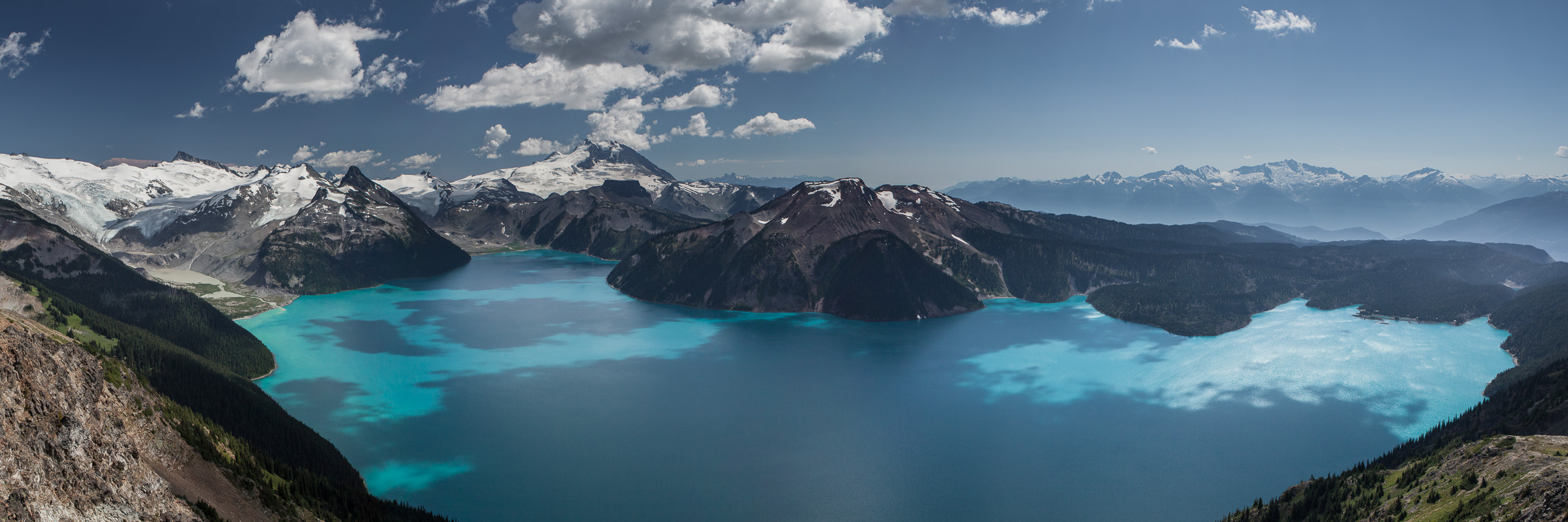 The incredible vista across Garibaldi Lake from atop the Panorama Ridge
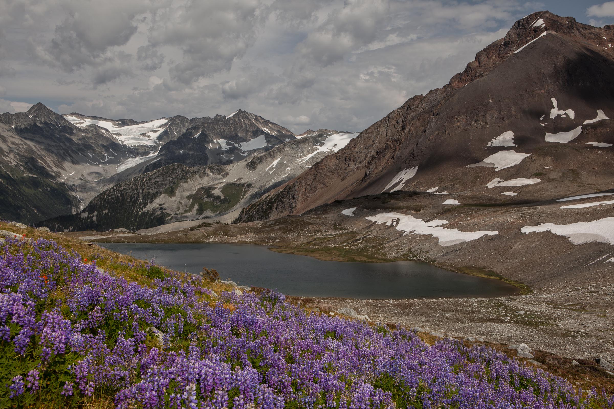
 Peaks above Whistler, seen from the Musical Bumps trail
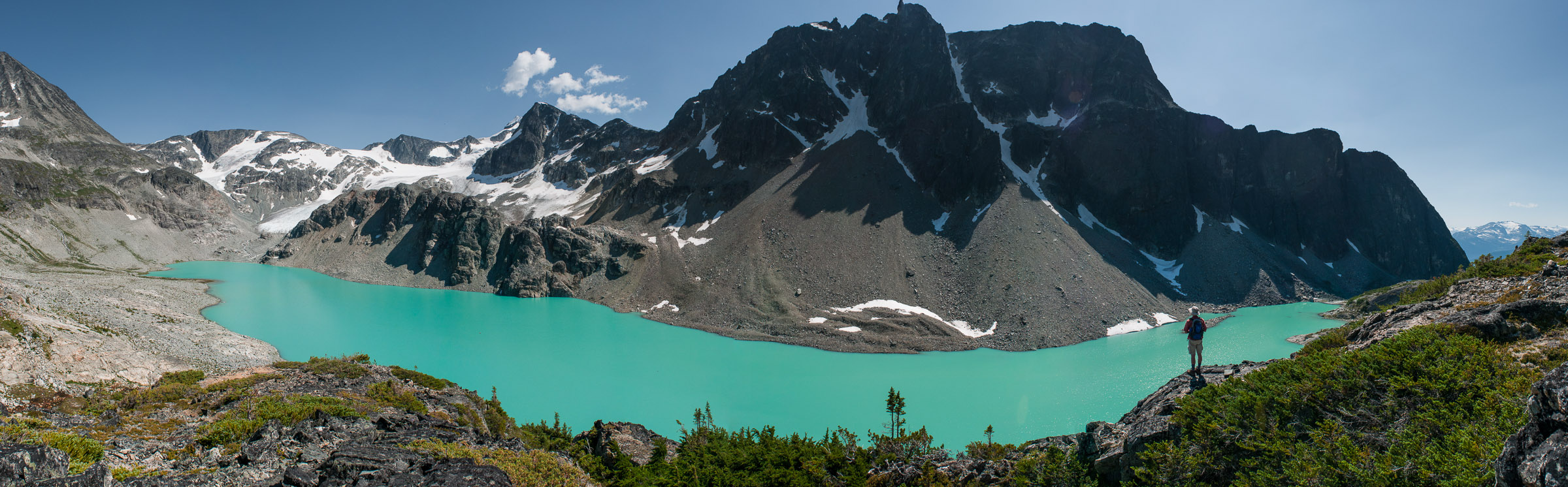 The panorama from above Wedgemount Lake, in the Coast Mountains